Thursday, 26 February 2026

Kolkata Metro Travel-2026: Know Map, Routes, Stations, Fare & Timings of kolkata Metro City

What is Kolkata Metro?

Kolkata is a city where history and modern life move side by side. While streets are famous for trams yellow taxis and hand pulled rickshaws. Fastest and most reliable way to travel across city today is Kolkata Metro. If you are planning for daily commuting or visiting city for first time understanding Kolkata Metro map, routes, stations, ticket price and timetable can make your journey smooth and stress free.Kolkata Metro is India’s first metro railway system. It started operations in 1984 and has grown steadily over the years. Today it connects major residential area, business districts, railway stations, and educational hubs.

People often search online for

  • Kolkata Metro route details
  • Kolkata Metro stations list
  • Kolkata Metro ticket price
  • Kolkata Metro train timings today
  • Kolkata Metro map pdf
  • How to travel from Dum Dum to Kavi Subhash

Kolkata Metro Route Finder

If your in kolkata and want to explore city then metro will be good option because it will reduce your travel time and also from heavy indian traffic.During this our Kolkota metro route finder will help you.you can for route finding and other info...https://kolkata.metroroute.co.in/

Kolkata Metro Map Way to Understand Metro Network

Kolkata Metro map is design in a simple, color coded format. Each metro line has different color and stations are shown in travel order.Map does not show exact road layout but focuse on routes and connectivity.
image source:wikipedia

During reading metro map you will notice:

  • Terminal stations at both end of each line
  • Interchange station marke clearly
  • Elevated and underground section
  • Connections to railway stations and bus terminals

If you are new to system just identify your starting station and destination station then follow the line between them.

Kolkata Metro Lines and Routes

Kolkata Metro currently operate multiple lines with some under construction and expansion.these lines are : 

Blue Line 

Blue Line is oldest and busiest route. It connect Dakshineswar to Kavi Subhash. This line passes through important stations such as:

  • Dum Dum
  • Shyambazar
  • Central
  • Park Street
  • Kalighat
  • Tollygunge

Green Line 

Green Line connect Howrah Maidan to Salt Lake Sector V. It include India first underwater metro tunnel under Hooghly River. Important stations on this line are :
  • Howrah
  • Esplanade
  • Sealdah
  • Phoolbagan
  • Salt Lake Sector V

Other Upcoming Lines in Future

New corridor are being develop to improve city connectivity including extension toward airport and suburban area. These expansion will make Kolkata Metro network even more convenient.

Kolkata Metro Stations and Facilities

Kolkata Metro station are design to handle large passenger volume daily. Most station provide have these facility : 

Kolkata Metro Ticket Price and Fare Chart

Metro use distance base fare system.longer distance higher fare but it remain affordable compared to taxis and other app base ride.Passengers can choose from:

Using smart card is cheaper and faster for daily commuter because it reduce queue time and offers small fare discount. 

Kolkata Metro Train Timings and Frequency

Generally
  • Trains start early morning
  • Services continue till late evening
  • Peak hour frequency is higher
  • Off-peak waiting time is slightly longer
During weekend and Sunday timing may vary slightly so checking updated schedule online is helpful before planning long trip.

How to travel using Kolkata Metro?

If you are using metro for first time follow these simple steps:

  • Buy a token or recharge your smart card
  • Clear the security check
  • Check the platform direction 
  • Board the correct train
  • Exit by scanning token or card at your destination

Important Interchange and Landmark Station

Dum Dum Metro Station 

Connect to suburban railway and airport road connectivity.

Park Street Metro Station

Locate near restaurant shopping area and office. 

Esplanade Metro Station

One of the busiest station,close to New Market and major bus route. 

Howrah Metro Station

Connect to Howrah Railway Station making intercity travel easier.

 Benefits of using Kolkata Metro

There are many reason why people prefer metro travel in Kolkata:
  • Faster than road traffic
  • Affordable daily commute
  • Less pollution
  • Safe and secure environment
  • Predictable travel time

Travel Tip for Kolkata Metro Passenger

  • Avoid rush hours if possible
  • Keep smart card recharged
  • Stand behind safety lines
  • Follow station announcements
  • Keep belongings secure

Future Expansion Plan

Kolkata Metro is expanding toward airport connectivity and outer suburbs. New line and extension will improve travel across  metropolitan region and reduce traffic congestion further.These project aim to:
  • Connect more residential areas
  • Reduce road pressure
  • Improve travel speed
  • Support economic growth

Kolkata Metro has become the backbone of urban transport in the city. From North to South and East to West it connect important neighborhood efficiently and affordably. Understanding the Kolkata Metro routes, station list, ticket price and timings can make your travel easy and stress free.

Whether you are commuting daily to work attending college or exploring cultural beauty of Kolkata metro is one of best transport option available.By learning the map once and using  smart card you can confidently navigate city without worrying about traffic or delay.

Also read 

Sunday, 22 February 2026

Hyderabad Metro : Map, Routes, Stations, Ticket Price, Timetable & Travel Tips-2026

What is Hyderabad Metro?

Hyderabad is one of India fastest growing cities  known for its technology hubs historic landmarks and busy roads. To make travel easier city developed Hyderabad Metro modern and efficient rapid transit system that connects major areas across the metropolitan region. Either you are daily commuter, student, office worker or tourist understanding Hyderabad Metro map and routes can save time money and effort.

This complete guide explains everything in simple language including Hyderabad Metro stations list, Hyderabad Metro ticket price, metro timetable, route planner tips, smart card usage and travel advice. If you are searching online for how to use Hyderabad Metro, metro fare detail or station connectivity this article covers it all in a natural and easy to follow way.

Hyderabad Metro is rapid transit public transport system design to reduce traffic congestion and improve connectivity across city. It is known for clean stations, elevated tracks, comfortable coaches and reliable train frequency.Metro connects residential areas, business centers, shopping zones and educational hubs.

Many people search for information like Hyderabad Metro route details, Hyderabad Metro train timings and Hyderabad Metro station connectivity before travelling.System is design so that even first time user can navigate it easily.

Hyderabad Metro Map Understanding Metro Network

Hyderabad Metro map displays metro lines, stations and interchange points using color coded routes. It is available at stations, online downloads and travel apps.Map simplifies city layout and focuses only on travel routes rather than detail geography.
hyderabad metro map
During reading metro map you will notice:

  • Each metro line shown in different color
  • Stations arranged in travel order
  • Interchange stations highlighted
  • Terminal stations indicating direction
This layout helps passengers quickly plan journeys and understand travel connections.

Hyderabad Metro Lines and Routes

Red Line

Red Line is busiest routes and connect major residential and commercial region of city.It cover important metro stations including Miyapur, Ameerpet and LB Nagar. This route is popular for office commuters and students.

Blue Line

Blue Line connects eastern and western parts of city. It serves key areas like HITEC City Raidurg IT corridor and Ameerpet interchange. Many professionals rely on this line daily.

Green Line

Green Line is shorter but important for connectivity. It links Jubilee Bus Station with Mahatma Gandhi Bus Station and provides interchange options for longer journeys.

Hyderabad Metro Stations and Facility

Hyderabad Metro stations are design for passenger comfort and safety. Travelers search online for Hyderabad Metro station facilities or accessibility options before commuting. Stations has facility like :
  • Escalators and lifts
  • Digital display boards
  • Security screening
  • Ticket counters and machines
  • Parking and feeder transport
Major interchange stations like Ameerpet allow switching between metro lines smoothly.

Hyderabad Metro Ticket Price and Smart Card

Hyderabad Metro ticket fare is important for budgeting daily travel. Ticket price depend on distance travelled. Passengers can buy tokens for single trips or recharge smart cards for regular use.Common options for ticket is:
  • Single journey token
  • Rechargeable smart travel card
  • Digital payment options

Many users search for Hyderabad Metro ticket price calculator or fare chart to estimate costs before travel.

Hyderabad Metro Time table and Frequency

Hyderabad Metro run frequently throughout the day. Exact timings vary but services typically begin in morning and continue until late evening. Peak hour frequency is high to manage rush crowds. Typical features:
  • Short waiting times during peak hours
  • Reliable scheduled departures
  • Timetable available online

How to Use Hyderabad Metro Route Planner

Route planning tools allow passengers to find exact info about source and destination station, fare,travell guide and other. If  you want  know about route info of Hyderabad metro use this foute finder .These tools help with:
  • Finding fastest route
  • Identifying interchange points
  • Estimating travel duration

Benefits of Traveling by Hyderabad Metro

  • Faster travel compared to road traffic
  • Affordable ticket options
  • Environment-friendly transport
  • Reduced stress and predictable journey time
  • Safe and comfortable travel environment

Travel Tips for Metro Passenger

  • Recharge smart card before boarding
  • Check metro map beforehand
  • Avoid peak rush when possible
  • Follow station instructions
  • Stand clear of closing doors

Future Expansion and Development

Hyderabad Metro network continues expanding with propose extensions to improve connectivity. Future growth aims to cover more suburbs reduce congestion and support urban development. Hyderabad Metro is essential part of the city transportation system. With well planned routes, accessible stations, affordable ticket options and reliable scheduling. it serves millions of passengers every year. After understanding Hyderabad Metro map, routes and fares ensures smooth travel whether commuting daily or visiting city.

By spending little time learning network travelers can confidently navigate Hyderabad using metro services and enjoy a comfortable journey across the city.

Read Also About

Saturday, 21 February 2026

Dubai Metro: Routes, Stations, Map, Ticket Price, Timetable & Travel Tips - 2026

What is Dubai Metro?

Dubai is a modern city known around world for its stunning skyscrapers, diverse culture and advance transport system. One of best way to explore Dubai is by using  Dubai Metro. Dubai Metro network is fast, clean, affordable and simple for both resident and tourist to use. In this comprehensive guide I will explain everything you need to know about Dubai Metro map, Dubai Metro stations, Dubai Metro ticket price, Dubai Metro timetable, lines, fare system.Whether you are visiting Dubai for first time or planning to use public transport regularly this guide will help you to understand metro system like a local.

Dubai Metro is rapid transit rail network that serve city of Dubai and connect to neighboring area including Sharjah and UAE wider transport network. Dubai metro is operate by Roads and Transport Authority (RTA) . it is one of most modern metro systems in world. Dubai Metro trains are fully automated, driverless, air conditio and design to provide a smooth travel experience.Metro helps millions of commuter every year to reach key destination such as business district, shopping center, beache, tourist attractions and residential communities.
dubai metro map

How to Read Dubai Metro Map

Dubai Metro map show all metro routes, station, interchange points and important landmarks. Metro map is available online in pdf format and inside every metro station.Key point to understand on the map:
  • Different lines are shown in different color
  • Each station is mark clearly
  • Interchange station have special icon
  • Map show approximate distance between station

Unlike regular city maps metro map is simplified meaning it does not follow exact street patterns but helps you focus on train routes and connection only.

Dubai Metro Lines

Dubai Metro network consists of multiple lines that serve city from different directions. These are:

Red Line

Red Line is most popular Dubai Metro route and expanded from UAE Exchange in south to Expo 2020 in south east. This line cover major area of Dubai including:

Because it connects directly to Dubai International Airport and major shopping destination Red Line is essential for both tourist and resident.

Green Line

Green Line run from Etisalat station to Creek station. This line passes through older part of city and serves communities such as:
  • Al Qusais
  • Festival City
  • Dubai Healthcare City
  • Baniyas Square

Green Line is widely used by daily commuter and provide access to local market and traditional neighborhoods.

Route Extensions and Future Line of Dubai Metro 

As Dubai continue to grow new line and extension are plan. These expansion aim to connect more neighborhood, improve travel speed and handle rising passenger demand.

What should you need to know?

Dubai Metro station is modern well organize and easy to navigate. Each station has facility like:
  • Automatic door
  • Clear signboard
  • Ticket vending machine
  • English and Arabic announcement
  • Customer service center
Many stations also offer facility such as toilet, vending machine, Wi-Fi and retail shop. Interchange station like Union Metro Station or BurJuman providing switching between Red Line and Green Line.Some station are also link to shopping mall, airport and bus connections making transfers convenient.

Dubai Metro Ticket Price & Fare

Understanding Dubai Metro ticket price is important before you start traveling. Dubai use a zone based fare system which means cost depend on how many zones you travel across.

Here are some key ticket option:

Nol Card

To travel on Dubai Metro you must have aNol Card. This card is rechargeable and used for:

  • Metro ride
  • Buse
  • Tram
  • Water transport

Types of Nol Cards:

  • Red Ticket: Best for visitor or short trip
  • Silver Card: Standard card for most commuter
  • Gold Card: Offers access to  Gold Class carriage
  • Blue Card: Personalize with added feature

How much does Dubai Metro cost?

Fare prices vary and  depend on:
  • Number of zones travelle
  • Class of travel (Standard or Gold)
  • Peak vs off peak time

Dubai Metro Timetable & Frequency

Keeping track of Dubai Metro timetable can help you plan journey smoothly and avoid delay.Typical timing details are:
  • Metro service usually start early in morning and run till midnight (weekdays)
  • Weekend timing might differ 
  • Frequency is high during peak hours like every few minute
  • Off-peak trains are also frequent and reliable

Dubai Metro Travel Tip

Whether you are a first time visitor or new resident here are some tips to help you to use metro.

1. Buy  Nol Card Before Your Ride

You can get a Nol Card at any metro station ticket office or vending machine. It is required for entry and exit.

2. Plan Your Route Using  Dubai Metro Map

Review metro line and statio before boarding so you know where to change trains if need.

3. Remember Peak Hour Crowd

Rush hour can be busy especially around business district. Try to travel slightly before or after peak time for comfort.

4. Use Gold Class for Extra Comfort

If you prefer  less crowd car with more seatin, choose Gold Class with  Gold Nol Card.

5. Follow Station Announcement

Announcement are made in English and Arabic so you will miss your stop.

Major Metro Station and Place You Can Visit

Dubai Metro connectsyou to many attraction and key places like : 

Burj Khalifa / Dubai Mall Station

This station offer access to world famous Burj Khalifa and Dubai Mall perfect for sightseeing and shopping.

Mall of  Emirates Station

Connected to one of the biggest mall in Dubai, this station is ideal for shopping, dining and entertainment.

Dubai International Airport Station

Both Terminal 1 and Terminal 3 are directly connected by metro making it perfect for traveler with luggage.

Dubai Marina

This lively area is popular for dining, boat tour and beach access.

How to plan your journey using  Dubai Metro route planner?

RTA provide Dubai Metro Route Planner online and through their mobile app. You can enter:
  • Starting station
  • Ending station
  • Date & time
Planner will show you:
  • Best route
  • Total travel time
  • Fare cost
  • Train changes (if needed)
This tool is useful if you want to optimize your journey quickly and avoid guesswork.

Accessibility & Comfort Feature

Dubai Metro station are built to accommodate all passenger comfortably. Some features are:
  • Wheelchair ramp and elevator
  • Priority seating
  • Clear tactile signage for visually impaired rider
  • Climate controll platform
  • Clean and safe environment
Families with young children elderly travelers and people with disability all find the metro easy to navigate.

Safety and  Security on Dubai Metro

Safety is top priority in Dubai Metro system. Security staff are present at station and on train. CCTV is active throughout network. Rule such as no smoking no eating and respectful behavior are enforced to ensure comfort for all passenger.

Benefits of Using Dubai Metro

Taking the metro has many advantages:
  • Affordable compared to taxis
  • Fast and punctual
  • Environmentally friendly
  • No traffic jam
  • Easy to navigate even for tourist

Future of Dubai Metro

Dubai continue to invest in it transport infrastructure. New lines extended route and advance service features are plan for future development. These improvement will make Dubai Metro map even more extensive and useful for everyday travel.

Dubai Metro is more than just a train system .it is a key part of modern city life in Dubai. With extensive coverage, simple navigation, clear metro routes, affordable fare and frequent service, it serves both daily commuter and visitor with efficiency.

Whether you are commuting to work, heading to airport or exploring Dubai famous attraction metro provides comfort, speed and convenience. Use tips in this guide to make the most of your metro journey and enjoy everything Dubai has to offer.

Doha Metro Map-2026 : Complete Guide to Doha Metro Stations, Routes , Fare and Lines

What Is the Doha Metro?

If you are planning to travel around Doha then understanding Doha Metro map is one of best thing
you can do before starting your journey.Map clearly show Doha Metro stations, metro routes, interchange point and line connection. Whether you are visitor exploring doha city or resident commuting daily  Doha Metro route map helps you move efficiently and avoid confusion.

Doha Metro is one of modern rapid transit systems in Middle East. it is Known for its clean station, fast train and reliable service.it connect major area of city including business district, residential zone and tourist location. In this guide you will learn how to read the Doha Metro map, understand metro lines, find station and plan trips with ease.

Doha Metro is high speed urban rail system located in Doha capital city of Qatar. It was develop to improve public transportation and reduce road congestion. Metro system feature fully automat train, air condition station and advance infrastructure designe for comfort and efficiency.The network mainly includes three major lines:
These lines intersect at key point and  allow passengers to transfer between routes quickly.
doha metro map

Understanding Doha Metro Map

Doha Metro map is design with simplicity in mind. It does not display every road or building but focuses on what travelers need to know  metro lines, stations and interchange hubs.Like most metro systems map uses a simplified layout rather than exact geography. This makes navigation easy especially for new user.Key feature of  Doha Metro rail map are:
  • Different colors for each metro line
  • Clearly mark station names
  • Transfer stations highlighted
  • Direction shown through terminal station

Doha Metro Lines Explained

Red Line 

Red Line is one of busiest route in doha metro network.This line is widely use by tourist and professional because it links key city attractions and travel hubs. It run north to south and connect important location including airport and major business zones.Important stations on Red Line are :
  • Lusail
  • Katara
  • West Bay
  • Msheireb
  • Hamad International Airport

Gold Line 

Gold Line run east to west across doha city and connect cultural and historic area. This line is ideal for exploring heritage location and local communities. It provide access to traditional market and residential districts.Some major stationsof golfen line are :

Green Line

Green Line serve educational institution and suburban district.It plays an important role in connecting academic centers with other parts of Doha. It is popular among students and resident commuting daily.Key stations of green lines are :

How to Read Doha Metro Route Map?

Step 1: Locate Your Starting Station
Find station closest to your location.
Step 2: Identify Destination Station
Search for where you want to go.
Step 3: Check Line Color
Confirm if both stations are on the same line or if you need a transfer.
Step 4: Follow Direction

Doha Metro station are known for their modern design and passenger friendly services. Common features are :
  • Escalator and elevator
  • Digital information display
  • Free Wi-Fi access
  • Clean waiting area
  • Security monitoring
Msheireb Station is central interchange hub where all metro lines meet, making it most important station on the map.

Doha Metro Ticket Price and Travel Card

Traveling on the metro requires a smart travel card. Fare price depend on travel class and duration.Typical ticket options are:
Doha Metro ticket price is affordable compared to taxi or ride share options. Rechargeable travel card allow seamless entry and exit at stations.

Doha Metro Timetable and Frequency

Doha Metro train operate frequently reducing wait time and making travel convenient.Typical service frequency:
  • Every few minutes during peak hours
  • Slightly longer intervals off peak
  • Extended service on weekends

Why is  Doha Metro Map useful for tourists?

Visitor benefit greatly from understanding Doha Metro line map. Many top attraction and shopping area are connect through metro routes. Learning metro map before traveling help tourists explore confidently without relying entirely on navigation app.Downloading the Doha Metro map PDF version beforehand is a good practice especially when mobile connectivity is limited.

Future Expansion of Doha Metro

Metro network is expect to expand as city grows. Future developments aim to:
  • Add new station
  • Improve suburban connectivity
  • Support urban development
  • Enhance accessibility
With each expansion Doha Metro network map will evolve reflecting the city progress.Tips for Using Doha Metro Efficiently.These simple steps make journeys smoother and more comfortable.

Helpful travel tips include:

  • Check metro operating hours before travel
  • Keep travel card balance updated
  • Follow station sign carefully
  • Avoid peak rush if  possible
  • Save offline metro map on your phone

Final Thought on Doha Metro Map

Doha Metro map is a practical tool that help resident and visitor to travel across city with confidence. Its color-coded lines, clearly labeled station and simple layout ensure easy navigation for everyone.Whether commuting daily or exploring city understanding Doha Metro route and station saves time and effort. As network expand, metro map will continue to guide millions of passengers efficiently throughout Doha.

Friday, 20 February 2026

Sydney Metro Map 2026 : Know How to Use Sydney Metro Map to find Stations, Routes and Lines -2026

What is Sydney Metro?

If you are planning to travel around Sydney then understanding Sydney Metro map is one of smart thing you can do.Map help you to see all Sydney Metro stations, metro routes, interchange point and line connections in one clear view. Whether you are tourist or daily commuter Sydney Metro route map will make your travel easier, faste and less stressful.

Sydney Metro is Australia first fully automated metro rail system. It runs frequently, connect key parts of the city and continue to expand. In this guide you will learn how to read Sydney Metro map and  understand different metro lines, find stations and plan your journey smoothly.

Sydney Metro is a modern rapid transit system in Sydne capital city of Australia. It operate separately fro traditional suburban train network and focuse on high frequency and fast travel. Train run every few minute during peak hour and making it one of most reliable transport option in city. Metro system currently includes major lines such as:
  • Sydney Metro Northwest
  • Sydney Metro City and  Southwest
    These lines connect residential area, business district and important city location.
Sydney Metro Map
image Credit:https://www.sydneymetro.info

Know  how to Use Sydney Metro Map

Sydney Metro map is design  simple and easy to read. It does not show every street in Sydney. Instead it focus on metro lines, stations and transfer point.

Here is what you will notice when looking at  Sydney Metro rail map:

  • Each metro line is shown in a different color
  • Stations are listed in travel order
  • Interchange stations are clearly mark
  • End stations show direction of travel

Map is not drawn exactly like real geography of Sydney. Instead it uses straight lines and simple curve so passenger can quickly understand route.

Explanation of Sydney Metro Line

Sydney Metro Northwest

Sydney Metro Northwest was first stage of the metro system.This line is popular among commuter who travel daily to business districts. It connect suburbs in north west region to  city. This line include important station like:
  • Tallawong
  • Rouse Hill
  • Castle Hill
  • Chatswood

Sydney Metro City & Southwest

Sydney Metro City and Southwest line connect north-west to Sydney CBD and further toward  southwest. It improve travel time and reduces congestion on older train line.Key stations on this line are:
  • Barangaroo
  • Martin Place
  • Central
  • Sydenham
This expansion has made Sydney Metro map more important than ever because new connections allow smoother transfers across the city.

How to Read the Sydney Metro Route Map?

Many people confused first time  when they see Sydney Metro station map but it is quite simple.

Step 1: Find Your Starting Station
Look for your nearest Sydney Metro station on map.
Step 2: Identify Your Destination
Locatestation where you want to go.
Step 3: Check the Line Color
Make sure both stations are onsame line or identify where you need to change train.
Step 4: Follow the Direction
Look at final station name at end of line. This tell you which platform direction to choose.
Once you practice this a few time, reading Sydney Metro network map becomes very easy.

Sydney Metro Stations List

Sydney Metro stations are modern and fully accessible. Most stations offer:
  • Lift and escalator access
  • Clear digital display boards
  • Platform screen doors
  • Contactless payment gates
Major interchange stations allow connection with buses, ferrie and suburban train. Central Station is one of most important interchange points in network.

Sydney Metro Ticket Price and Opal Card

When traveling on Sydney Metro you need an Opal card or contactless payment method. Ticket prices depend on:

  • Distance traveled
  • Peak or off-peak timing
  • Adult or concession category
Sydney Metro ticket prices are generally affordable and similar to other Sydney train fares. Using contactless bank cards or mobile payments is also allowed.

Sydney Metro Timetable and Frequency

One of  biggest advantages of Sydney Metro is train frequency. Unlike traditional train that run every 15-30 minutes metro trains operate every few minutes during peak hours.Typical frequency:
  • Every 4-5 minutes during peak
  • Every 7-10 minutes during off-peak
  • Extended services on weekendsBecause trains are driverless and automated delays are less common compared to older systems.

Why Sydney Metro Map is important for tourists?

If you are visiting Sydney Sydney Metro line map can save your a lot of time. Many popular attraction are accessible via metro connection. Instead of depending completely on mobile app, knowing how to read the metro map gives you confidence.

Tourists often use tSydney Metro map PDF version online before their trip. Studying map in advance help to reduce confusion at busy stations.

Future Expansion of Sydney Metro

Sydney Metro network is still expanding. New stations and lines are under construction to serve growing suburbs. As new stages openSydney Metro map will continue to update.This growth make Sydney Metro one of the most advanced transport projects in Australia.

Future expansions aim to:
  • Reduce traffic congestion
  • Improve airport connectivity
  • Connect more residential areas
  • Increase overall travel speed

Tips for Using Sydney Metro Efficiently

Here are some simple travel tips:

  • Check Sydney Metro timetable before peak hour
  • Stand on left side of escalator
  • Follow platform sign carefully
  • Use contactless payment for faster entry
  • Download Sydney Metro map online for offline access Small preparation makes your journey smooth and stress free.

Final Thoughts on Sydney Metro Map

Sydney Metro map is more than just a transport diagram. It is a guide that help people move confidently across Sydney. With clearly mark station colorcoded line and simple design, metro map makes urban travel easy.

Whether you are a daily commuter, student or visitor knowledge of  Sydney Metro route and stations will save your time and effort. As network expand,map will continue to play an important role in Sydney transport system.

If you spend just a few minutes studying Sydney Metro rail map, you will feel much more comfortable navigating the city.

Saturday, 14 February 2026

Kochi Metro: Know kochi metro stations timings , route map ,stations list ,ticket booking

Overview of Kochi Metro

Kochi is fast developing and modern city of kerala.In 2017 kochi metro was started to solve high traffic problem.Today kochi metro is not  transport system of kochi but it has become identity of kochi.In this blog post I will cover everything about kochi mtero like kochi mtero station,kochi metro timing,kochi metro route,kochi metro stations,kochi metro online ticket booking and whattsapp number of kochin metro.

Kochin Metro Stations

Stations of kochi metro has made with modern design. Arrangement of cleanliness, lift,escalator and digital information board are done at every metro station of kochi metro.Security at every station is  very strict and CCTV camera has installed .At present only one line is operational in kochi metro that is 26 km long and connect Aluva and Petta.There are 22 metro station lie on this line.

Kochi Metro Stations List - 2026

These are complete list of  operational station of kochi metro:
  • Aluva
  • Pulinchodu
  • Companypady
  • Ambattukavu
  • Muttom
  • Kalamassery
  • Cochin University (CUSAT)
  • Pathadipalam
  • Edapally
  • Changampuzha Park
  • Palarivattom
  • JLN Stadium
  • Kaloor
  • Town Hall
  • MG Road
  • Maharaja College
  • Ernakulam South
  • Kadavanthra
  • Elamkulam
  • Vyttila
  • Thaikoodam
  • Pettah

Kochi Metro Timing

Kochi metro is reliable option because its time table is fixed and puntual.Metro is relaible, easy and perfect option for office goers and students.this is official time table of kochi metro is :
  • Morning First Train: 6:00 AM
  • Last Train:10:30 PM
  • Frequency: During Peak hours trains frequency is  5-7 minutes but during non-peak its frequency is 10-15 minutes.
kochi metro timing

Kochi Metro Route Map

Kochi metro route is very strategic and it cover major area of kochi city.it start from Aluva, Edapally, Palarivattom, Kaloor, MG Road aur Maharaja College and connect all busy area.

Route is very convient for those people who daily travel from Aluva to Ernakulam. Metro route is design in such a way that traveller will spent minimum time as compared to auto and bus to reach their destination.

if you want to find any station on metro map then at every station you can see digital  and printed map in permises of metro station. Kochi metro map helps traveller to find their destination stations.

In metro map it is very clears that which station is near your locality and where is your destination station. Kochi metro map is also available on kochi metro official website and anyone can download it. Here we have also upoad the metro map.
kochi route map

Kochi Metro Ticket Booking

Metro ticketing is smart and easy. traveller has multiple option to book metro ticket. these options are
  • Ticket Counters: Ticket counter is available at every station and user can book ticket easily.
  • Automatic Ticket Vending Machines (TVMs): These are screen touch machine where user can book theirs ticket by using either upi or card payments.
  • Kochi1 Card:  this is a smart cart and cardholder can recharge his card and no need to book counter ticket. Just use this card get access inside the metro station. 
  • Mobile Apps: by using Kochi1 App you can book online ticket and using QR codeyou can travel.

Kochi metro Ticket Price and fare System

Metro ticket price and fare system are given below in table form
koch metro fare system

Also read 

Noida Metro: Route Map , Fare , Timing, Station and Metro Lines -2026

Overview of Noida Metro

Noida has grown rapidly over the past few years. From IT park and corporate office to residential society and shopping mall, city has become an important part of Delhi NCR region. With this fast development came traffic congestion and longer travel time. To make commuting smoother and more reliable,Noida Metro was introduce.Today Noida Metro play an important role in connecting different part of city and providing a comfortable travel option for daily commuter.Noida Metro is operate by Noida Metro Rail Corporation (NMRC). It is known for its clean station, punctual service and well maintain train.Metro system is design mainly to serve resident of Noida and Greater Noida while also providing easy connectivity with Delhi Metro network.Noida Metro focuse on eco friendly transport and help to reduce pollution and road traffic.

Noida Metro route mainly operate on Aqua Line. This line connect Noida Sector 51 to Depot Station in Greater Noida. Aqua Line passes through many residential sector, commercial area, and office hub that  make it very useful for working professional and student. At Sector 52 passenger can easily interchange with Delhi Metro Blue Line through a short walkway.
noida metro map

Noida Metro Station List

Knowledge of  Noida Metro station list help passengers to plan their daily journey easily. Each Noida Metro station is clean, well organized and equipped with modern passenger facility.Some major stations on Aqua Line in noida metro are :

  • Noida Sector 51
  • Noida Sector 50
  • Noida Sector 76
  • Noida Sector 101
  • Noida Sector 81
  • NSEZ
  • Noida Sector 83
  • Noida Sector 137
  • Noida Sector 142
  • Noida Sector 143
  • Noida Sector 144
  • Noida Sector 145
  • Noida Sector 146
  • Noida Sector 147
  • Noida Sector 148
  • Knowledge Park II
  • Pari Chowk
  • Alpha 1
  • Delta 1
  • GNIDA Office
  • Depot Station

Noida Metro Time Table

Noida Metro time table is design to suit daily office commuter and regular traveler.Train generally run on time making Noida Metro a reliable option
  • First train starts 6:00 AM.
  • Last train 10:00 to 10:30 PM.
  • Train frequency during peak hour available every 7 to 10 minute.
  • Train frequency druing  non peak hours is around 12 to 15 minutes..

Noida Metro Map

Noida Metro map is simple and easy to understand. It show  entire Aqua Line with clearly mark station and interchange point.Metro map help passengers to identify nearby station, plan the fastest route and estimate travel time. Map are available at station inside coache and on official platform.

Facilities at Noida Metro Station

Every Noida Metro station offer passenger friendly facility such as escalator, elevator, clean platform, CCTV surveillance, digital display board and trained security staff.Facility for senior citizen and differently able passengers are also provided. Parking and feeder bus services are available at select station.

Ticket System and Smart Card

Noida Metro ticket fare is affordable. Passenger can use single journey token, return tickets or rechargeable smart card.Smart card is especially useful for daily commuter as they save time and allow quick entry and exit at station.

Why Noida Metro Is Important?

Noida Metro play a key role in improving urban transport by reducing traffic congestion,lowering pollution level, and saving travel time. It improves connectivity between Noida and Greater Noida and supports city rapid growth.Metro also encourage people to shift from private vehicle to public transport.

Final Thought

Noida Metro has made daily commuting easier for thousand of resident. With a well plan Noida Metro route clear Noida Metro map, reliable Noida Metro time table and modern Noida Metro station, it offers smooth and stress free travel experience.For anyone living or working in Noida or Greater Noida the metro is one of best ways to travel across the city.

Also Read

Friday, 13 February 2026

Chennai Metro: Knnow Map,Metro Station,Time Table and Fare -2026

Overview of Chennai Metro

Chennai is one of India busiest metropolitan city. It is known for its IT hub, industries, beache, temple and educational institution . this city see million of daily commuter. With increasing population and vehicle on road, traffic congestion became major challenge. To provide a fast, cleaner and more reliable mode of transport Chennai Metro was introduce.Today Chennai Metro has become an important part of the city public transport system and  it is helping people travel comfortably across different area.

Chennai Metro is operate by Chennai Metro Rail Limited (CMRL). It is one of most modern metro systems in Indi that is known for its clean stations, punctual train and passenger friendly facility.Metro network include both underground and elevated section and allowing smooth travel through crowded city area and heritage zone.Metro is design to reduce road traffic, save travel time and promote eco-friendly transportation.

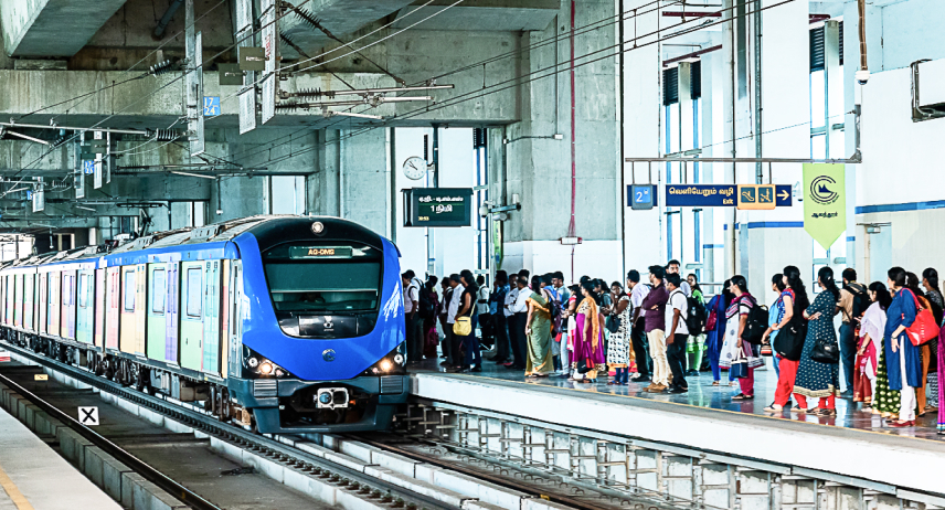
Blue Line runs from Wimco Nagar to Chennai International Airport. This line connect important residential area, business zone and airport, making it very useful for daily commuter and travelers. Green Line runs from Puratchi Thalaivar Dr. M.G.R Central Metro to St. Thomas Mount. This route connect Chennai Central Railway Station with southern part of the city.Both lines intersect at key stations like Alandur and Central, allowing easy interchange.
chennai metro
Image Source : https://chennaimetrorail.org/

Chennai Metro Station List

Knowledge of  Chennai Metro station list help passenger  to plan their journey better. Some important stations on Chennai Metro network are:
  • Wimco Nagar
  • Washermenpet
  • Mannadi
  • High Court
  • Puratchi Thalaivar Dr. M.G.R Central
  • Government Estate
  • LIC
  • Thousand Lights
  • Teynampet
  • Nandanam
  • Saidapet
  • Guindy
  • Alandur
  • Meenambakkam
  • Chennai International Airport

Chennai Metro Time Table

Chennai Metro time table is designed to suit early morning and late evening commuters.
  • First metro 5:30 to 6:00 AM.
  • Last train  11:00 PM.
  • During peak hours, trains arrive every 5 to 7 minutes.
  • During non peak hours, the frequency is around 10 to 15 minutes.

Chennai Metro Map

Chennai Metro map is simple and color coded making it easy to understand even for first time user. Each metro line is shown in different color and interchange stations are clearly mark.Metro map help passenger identify nearby station plan shortest route and estimate travel time. Map is available at station inside coache and on official platform.
chennai metro map

Facility at Chennai Metro Station

Every Chennai Metro station offer passenger friendly facility such as escalator, elevator, clean platform, CCTV surveillance, digital display board and train security staff.Facility for senior citizen and differently abled passenger are also provide. Some stations have parking area and last mile connectivity options like buse and auto.

Ticket System and Smart Card

Chennai Metro ticket fare is affordable and flexible. Passenger can choose between single journey token, return ticket and rechargeable smart card.Smart card is ideal for daily commuter as they save time and offer quick entry and exit at station.

Why is chennai metro important?

Chennai Metro play  major role in reducing traffic congestion, lowering air pollution, saving fuel and improving overall city mobility. It connect key residential, commercial,and transport hub efficiently.With future expansion under Phase 2, Metro network will cover more part of city and serve even more passenger.

Final Thought

Chennai Metro has made city travel faster safer and more comfortable. With well-plan Chennai Metro route a clear Chennai Metro map,reliable Chennai Metro time tabl and modern Chennai Metro station it has become one of best travel option in city.For anyone living in or visiting Chennai, Metro is a smart and stress free way to move around.

Also Read

Thursday, 12 February 2026

Delhi Metro Map: Makes Your Delhi Metro Journey Easy With our Metro Guide

What is Delhi metro map and how to find metro Station?

Delhi Metro is one of best and efficient convenient and transportation system in india. This is a rapidly growing city where more than one lakhs passengers use metro perday. Delhi metro is known as  lifeline of delhi. If you are living in Delhi or  you are travelling in Delhi then delhi metro map will be a essential tool for you because with the help of this map you can visit a cross the city. 
delhi metro

Delhi metro map will help you to find out the nearest metro station. Delhi Metro network has been divided into many lines and this lines connect all the location of Delhi. Lines are clearly mark on the map by using different colours code.By using this map you can plan your root and also understood about interchange point. 

If you are new in Delhi or you have plan first time to travel by metro then delhi Metro map will be quick reference guide for you. This map will help you to reach your destination. Delhi Metro cover all the famous landmarks market business hub and tourist spot hence use this metro map to reach your destination easily. 

Delhi Metro map has usual friendly designed and it is available in digital and physical form. Physical form of metro map is available on all the metro station. If you are using smart phone then you can download this metro map from internet. It is available online for everyone.

Delhi Metro Lines and Routes

Delhi metro network consists of multiple lines and each line is represented by a unique color on map. These lines cover different parts of city and are design to ensure smooth connectivity across Delhi and nearby region.

Red Line connect Rithala to Shaheed Sthal and serve many residential area.Yellow Line run from Samaypur Badli to HUDA City Centre and passing through major hub like Rajiv Chowk. Rajiv Chowk is one of busiest interchange station in  delhi metro network.

Blue Line is one of  longest and most important route that connect Dwarka to Noida Electronic City and Vaishali. It play key role in linking Delhi with neighboring city.Violet Line connect Kashmere Gate to Raja Nahar Singh  and covering both historical and modern area.

Pink Line (Ring Line) form a loop around city and connect multiple line and reducing travel time. Magenta Line provide direct connectivity between Botanical Garden and Janakpuri West including access airport via interchange.

Airport Express Line is another major highlight offering fast connectivity between New Delhi Railway Station and Indira Gandhi International Airport.

On Delhi metro map interchange station are clearly mark and allowing passenger to switch lines easily. These station are crucial for efficient travel across metro network.Understanding these route help you plan better reducing travel time and navigate city like a pro.

 Important Stations and Interchange Points of Delhi metro

While every station in Delhi metro network is important but some stand out due to it connectivity and location. These station are highlight on metro map and act as major transit hub.

Kashmere Gate is one of largest interchange station that connect Red, Yellow and Violet Line. It play a key role in linking different part of city.Other major hub is Rajiv Chowk locate in heart of Delhi and  connect Blue and Yellow Lines.

Station like Central Secretariat and Hauz Khas are also important interchange points allowing passenger to switch between multiple line and save travel time. These station are usually crowded but highly efficient.Delhi Metro map clearly mark these interchange point with special symbol making them easy to identify. Each station name is written in both Hindi and English and ensuring accessibility for all passenger.

Many station are locate near popular landmark and market making them convenient for tourist. For exampl Chandni Chowk station provides access to one of oldest market in Delhi while Qutub Minar station connect to historical sites.Knowledge of  these stations in advance allow you to plan your journey efficiently avoid unnecessary delay and travel confidently across the city.

Also read


Bangalore Metro (Namma Metro): Making Travel Easier in India Tech Capital with our metro guide

Overview of Bangalore Metro

Bangalore is known as Bengaluru and is India’s IT capital and one of fast growing city in country. With thousand of tech professional, student and business traveler moving across city every day. Traffic congestion is major issue for long time. To solve this problem and offer reliable public transport option, Bangalore Metro was introduce which is popularly known as Namma Metro.Today Namma Metro has become an important part of daily life for many Bengalurean.

Bangalore Metro is operat by Bangalore Metro Rail Corporation Limited (BMRCL).Metro system is modern, clean and well managed. It is design to reduce travel time, lower pollution and make commuting comfortable for people of all age group.Metro network includes both underground and elevated sections, especially in busy city area like Majestic and central business district.

Bangalore Metro route currently operate mainly on two major corridors.Purple Line run from Whitefield (Kadugodi) to Challaghatta. This line connect IT hub, commercial area and residential neighborhood across east-west stretch of city.Green Line run from Nagasandra to Silk Institute. This route connect northern and southern part of Bangalore including industrial area and educational zone.Both line intersect at Nadaprabhu Kempegowda Station, Majestic, which is the main interchange station.

Bangalore Metro Station List

Knowledge of Bangalore Metro station list help passenger plan their travel more efficiently.Each Bangalore Metro station is equipped with modern facility and clear signboard. Some important station on Namma Metro network are :
  • Whitefield (Kadugodi)
  • KR Puram
  • Indiranagar
  • MG Road
  • Cubbon Park
  • Vidhana Soudha
  • Majestic (Nadaprabhu Kempegowda Station)
  • Yeshwanthpur
  • Nagasandra
  • Jayanagar
  • Banashankari
  • Silk Institute

Bangalore Metro Time Table

Metro is known for punctual service which help commuter to save valuable time.Bangalore Metro time table is design to support early morning and late evening commuter.
  • First metro train  starts 5:00 to 5:30 AM.
  • The last train run 11:00 PM.
  • During peak hours trains arrive every 4 to 6 minute.
  • During non peak hours frequency is around 10 to 15 minute.

Bangalore Metro Map

Bangalore Metro map is color code and easy to understand. Each metro line is shown in a different colo and interchange station are clearly mark.Metro map help passenger to identify nearby station, choose shortest route and estimate travel time. Metro Map is available at station, inside train and on official platforms.
nama metro map
image sourece:https://commons.wikimedia.org

Facility at Bangalore Metro Station

Every Bangalore Metro station offer passenger friendly facility such as escalator, elevator, clean platform, CCTV surveillance, digital display board and security staff.Facility for senior citizens and differently abled passenger are also provided. Parking and feeder bus services are available at selected station.

Ticket System and Smart Card

Bangalore Metro ticket fare is affordable and flexible. Passenger can choose between single journey token, return ticket and rechargeable smart card.Smart card is highly recommended for daily commuter as they allow quick entry and exit and save waiting time.

Why is  Bangalore Metro important?

Bangalore Metro play key role in reducing traffic congestion, lowering air pollution and improving urban mobility. It connect major IT park, residential area, shopping zone and transport hub efficiently.With future expansions under Phase 2 and beyond metro network will cover more area of the city.

Final Thought

Bangalore Metro or Namma Metro has transform way people travel in city. With well plan Bangalore Metro route,clear Bangalore Metro map, reliable Bangalore Metro time table and modern Bangalore Metro stations . it offers a comfortable and stress free commuting experience.For anyone living in or visiting Bangalore Nama metro is one of smart ways to travel across city.

Featured post

VidsSave Brings More Flexibility to the Way Users Access Facebook Videos

Video quality has become an important part of online entertainment experience. With better smartphone display, faster internet connection an...